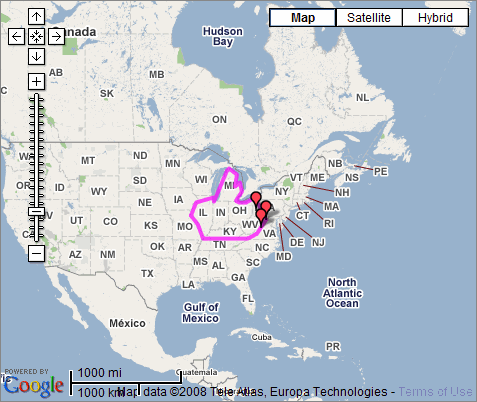
Enhanced Map of 1738-1770 Augusta County, Virginia
Map showing approximate boundaries of Augusta County, Virginia, 1738-1770:

Snapshot of Google Map showing boundaries of old Augusta County
About the original boundaries of Augusta County, Virginia
The original boundaries of Augusta County, Virginia were from the Blue Ridge Mountains in the east to the Mississippi River in the west, and from the North Carolina border in the south to the Great Lakes in the north. Ref: (Peyton, pp.3-4; Waddell, p. vi).
Return to scan of original static map which appeared unnumbered at the very beginning of the 1902 edition.
See more maps: static maps scanned from Waddell's Annals.